 |
|
||
|
|
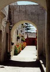
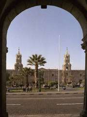
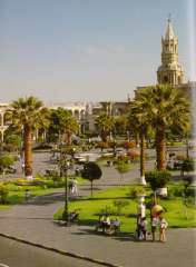
Arequipa
LOCATION
GETTING THERE A branch the South Pan-American road leads up from the coast to Arequipa connecting it with Lima and Tacna. There are 1,020 krn (632 miles) between Arequipa and Lima and 400 km (248 miles) between Arequipa and Tacna.
MEJIA LAGOONS The Mejia Lagoons National Sanctuary is located on the coast of Arequipa, near the mouth of the Tambo river, 20 km (12.4 miles) south of the port of Mollendo and 150 krn (93 miles) from the city.
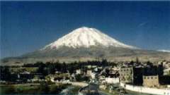
AGUADA BLANCA AND SALINAS Behind the Misti volcano, as seen from the city, over an extensive plain at 4,000 meters (13,120 feet) a.s.l. is the Aguada Blanca dam, declared a National Reserve. It is a rather shallow and artificial lake originated by the Blanco river containment. A little to the south, behind the Pichu Pichu peak, is an even larger lagoon called Salinas. These lagoons are a place for resting and nesting for a large population of birds like the colorful flamingos. There is a strong migratory relationship between these birds and the ones from Mejía, 180 km (111.6 miles) from Salinas. PAMPA CAÑAHUAS Located at the Aguada Blanca National Reserve, behind the Chachani peak. At about 4,000 meters (13,120 feet) a.s.I. this larger plain represents one of the best habitats for the protection of vicuñas. a Peruvian camelid, internationally known for its fine fleece. In Pampa Cañahuas, these animals can be seen running completely free and, therefore, without the shyness and apathy that seems to characterize them under captivity.
To the north of Arequipa is the higher course of the Colca river valley which deep canyon is renowned among rafters. The section previous to the canyon consists of an encased valley that runs from east to west, beginning in the cold puna and running down to warmer regions, showing its great scenic beauty and cultural attractiveness. COLCAS One of the survival skills of the ancient Colca people was the ability to store large amounts of grain for hard times the warehouses, known as 'colcas', gave name to the valley. In the 'cool' caves of Pumunuta, it is possible to see circular colcas a meter (3.28 feet) in diameter, mad of mud and straw.
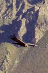
RAFTING ALONG THE COLCA-MAJES RIVER From December to March, expert and trained rafters can go along the high and middle section of the river, explored by the 1979 Polish expeditions. It includes very difficult and isolated rapids, as the towns are far from the torrent. Although the low section may be ran over in rubber rafts, only expert people, trained in kayac rafting can do it in the canyon sections. The name of the Colca river changes as it flows down to the Pacific ocean, Past the canyon; its name is Majes. Here, there are more chances for tourists to go in rubber rafts. The chances of finding shelters and access ways are better. Although its navigable section (Andamayo-Aplao river) does not have long rapids, the beauty of landscape and the clean river course allows enjoying the comfortable trip. The area is open year round to visitors. ETHNIC RICHNESS An ethnic group, bearer of ancient and still strong traditions, has dwelled the valley for more than 2,000 years. They are the Collaguas who arrived to the Colca valley from the high regions and seem to be descendants of the Aymaras because of their language and customs. Even under the Inca dominion, they kept themselves relatively Independent, and preserved their own traditions. It is sold that the supreme Inca Mayta Capac married a Collagua princess in order to formalize the conquest of the valley, and he built for her an elegant country house made of copper, near Sibayo. PETROGLYPS The early settlers of the valley left their own peculiar trace in petroglyphs such as Sumbay and Toro Muerto. Dancers with bizarre headdresses, different mammals, condors, and lines of unbreakable codes encompass the repertory of vast figures. CHURCHES There are almost 20 towns along the valley, which people preserve the ethnic richness of their past more than any other region of the country. The main ones are Chivay, Cabanaconde, Huambo, Maca, Achoma, Yunque, Larl and Coporaque, all very religious towns, whose Catholic faith also keeps alive pre-Columbian elements. Each town has its own church, bearer of its Hispanic and an example of architectural sobriety and purity based on the ashlar stone. VALLEY OF THE VOLCANOES Entering the -so called- 'Valley of the Volcanoes" of Andagua means going back several geological eras to witness some outstanding phenomena that only happen in two places In the world: the Canary Islands and In this Arequipa valley.
HOT SPRINGS Because of the volcanic nature of the region, there is hot springs in different areas of the valley. The main ones are Yunque, Chivay, Callalli, La Calera, Huancarama, Yura and Jesus. Furthermore, these hot springs are frequently related to 'puquiales", natural sources of cold, extremely pure and 100% potable water. Spectacular airplane flights are available allowing a unique and extraordinary view of the main attractions of Colca, that can only be seen from the air. There are landing strips in Huambo (in the canyon), Orcopampa (near the Volcano Valley), Coporaque (the high part of the valley), Tiabaya, near Arequipa and also from the city airport. |
|
| |||||||||||||||||||||||||